Environmental Assessment
When DANR is asked to conduct an environmental assessment, the department performs a detailed review of the project. This includes identifying permitting or regulatory requirements, documented environmental spills or releases, registered storage tanks, and potential water quality, drinking water, or water rights issues.
As of January 1, 2024, all requests must be submitted through the South Dakota Citizen Portal. You will need to create an account. Once submitted, you can return to the request to add required information or comments. You will receive responses in the portal and via email (check your spam folder if needed). We encourage early consultation. Please allow sufficient time for the 30-day review.
If you have questions, call 605-773-3296 or email DANREA@state.sd.us.
EA Submittal Requirements
The 30-day review process begins AFTER DANR receives ALL of the following information:
- Contact information (name, mailing address, email address, and phone number) of the person submitting the request for review.
- Project name and description (conceptual or complete), including the proposed activity or future use, timeline, and location (section, township, range, AND latitude/longitude).
- Specific concerns or issues you wish DANR to address (specify if you need only certain information rather than a full agency-wide review).
Project areas covering multiple cities or counties should include detailed maps. If a map does not clearly define the project scope, DANR may request additional information.
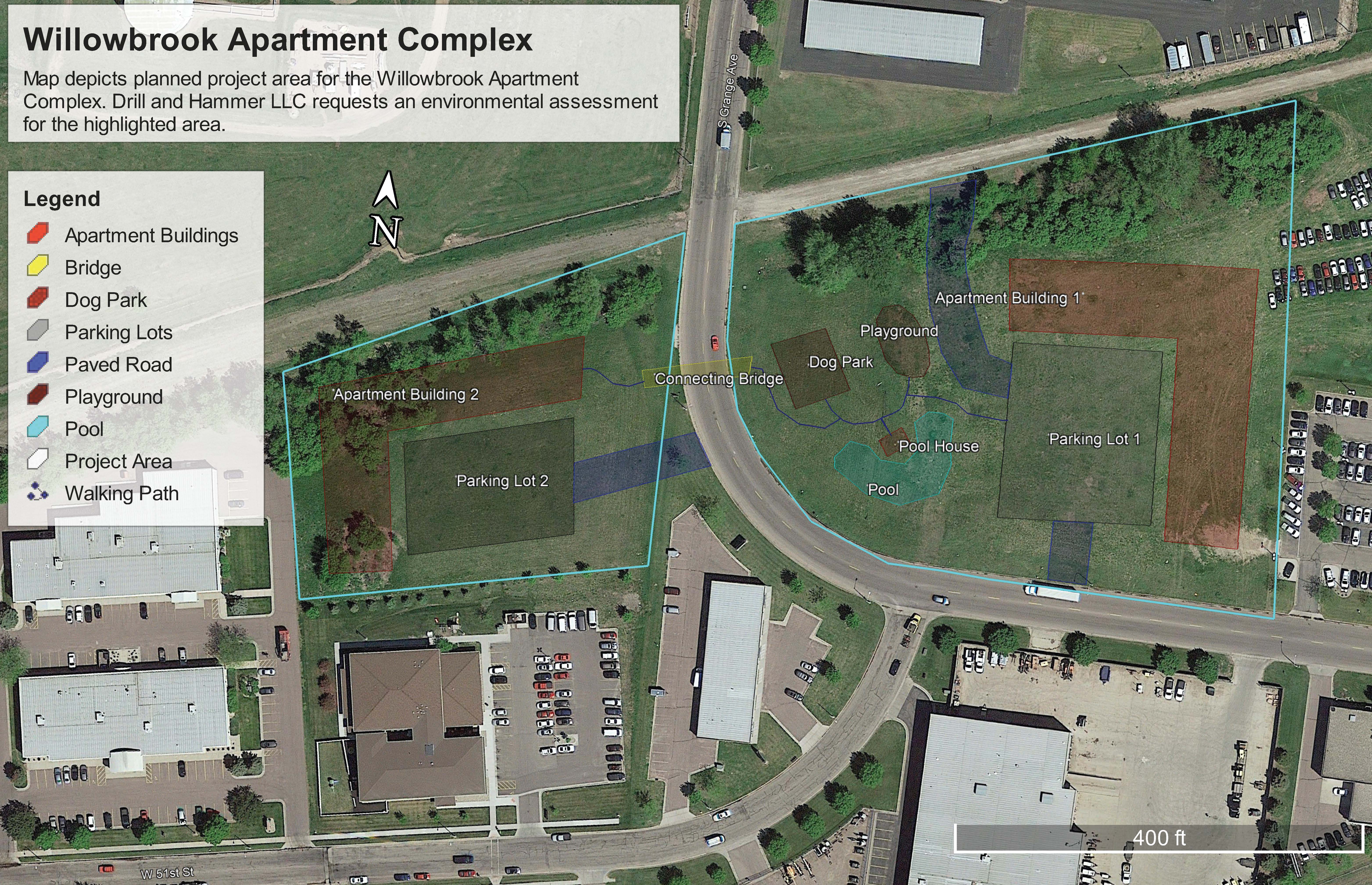
Aerial photos and/or maps must include:
- Project name
- Labeled streets, waterbodies, and other landmarks
- Legend for information on the map
- Compass/north arrow
- Outline around the project area
- Outline around any "off-site" areas used for communication, power, energy infrastructure, waste sites, access/haul roads, disposal areas, stockpiles, or staging equipment
Please Note:
DANR maintains several databases that store statewide information relevant to FOIA and record requests. If the information you need is available online, please use the databases instead of submitting an EA request.